Category Archives: Old Alignment

Old State 67 near Ramona

Between 1970 and 1979, State Highway 67 was realigned between Archie Moore Rd and Mussey Grade Rd. This realignment left two sections of paving with white striping intact. Most likely, the paving dates to around 1948 when State 67 was realigned around San Vicente Reservoir.

At Kay Dee Ln, only a section remains intact.
East of Kay Dee Ln, another section with striping intact.
Old C-monument right of way marker
Pavement here is broken up as the alignment rejoins State 67.

Old US 99 in Colton, CA

Realigned sometime in the 1930’s, the original alignment of US 99 is still visible near the intersection of Valley Blvd and Pepper Ave. Little remains of the original paving of US 99 through the Los Angeles area, so this is a special section.

Looking west along the original paving.
Original paving, looking east.
Cross section of the original paving. Note the lack of rebar. This is most likely from the 1910's.
Cross section of the original paving. Note the lack of rebar. This is most likely from the 1910’s.

Around late 2007, Valley Blvd was again realigned to better accommodate traffic at the I-10 interchange. Sections of the 1930’s paving are now sticking out from under the asphalt.

Colton welcome sign and old Valley Blvd.
Concrete from the 1930's visible under the asphalt cover.
Concrete from the 1930’s visible under the asphalt cover.
Looking west along Valley toward Pepper Ave.

Related Links:

Out of the Lake: Old Highway 178 and the town of Isabella

Long before the Isabella Reservoir was built in the 1950’s, State Highway 178 passed through the Kern River Valley on an alignment much different than it is today.

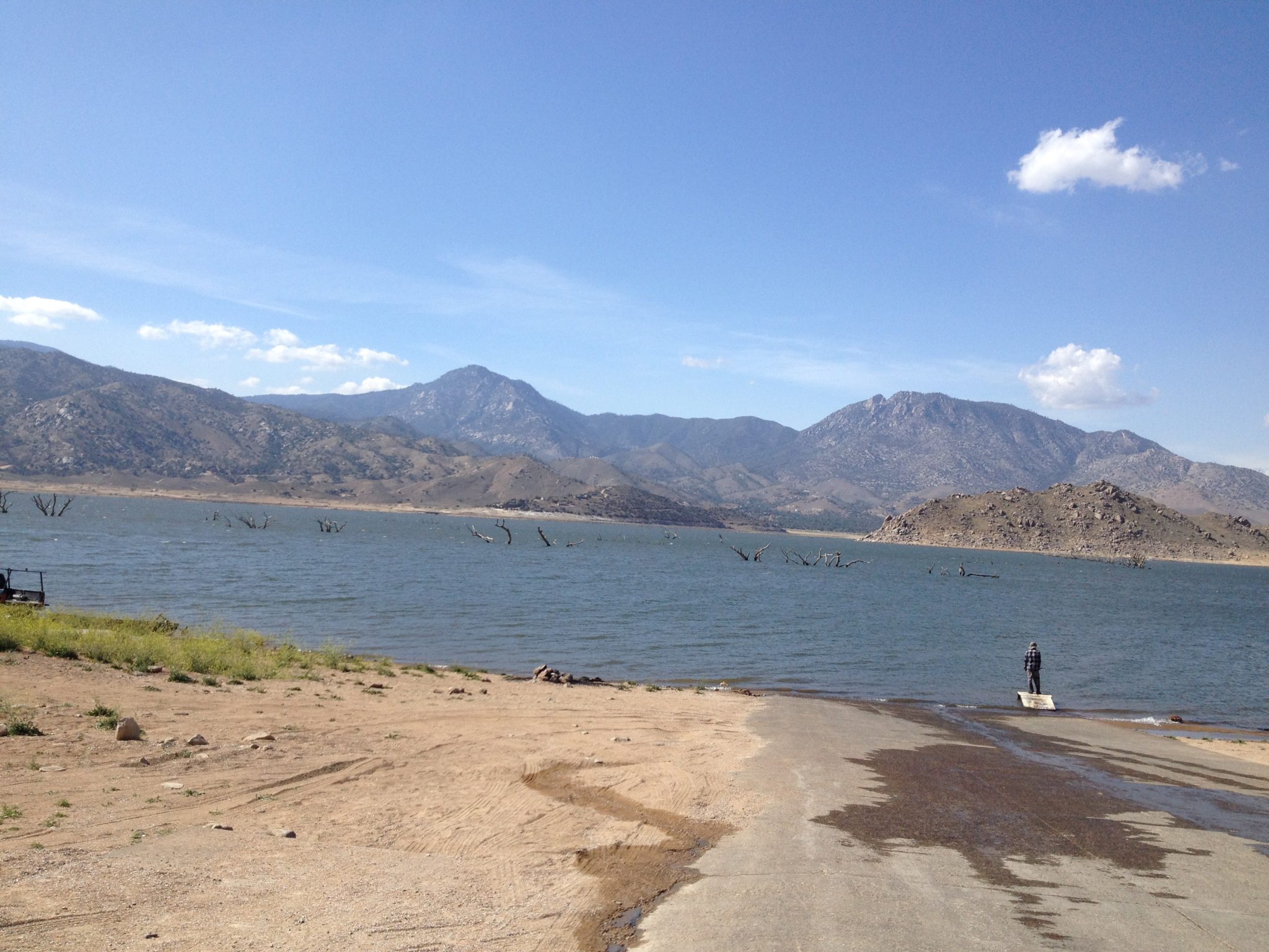
With the current drought, Lake Isabella is a puddle of what it used to be…but it’s amazing what the lake has hidden all these years.  The lake has not been this low since 1977 and is the second lowest level since the dams were finished in 1953.

In April, I took two trips back to the areas near where the original towns of Isabella and Kernville stood before the lake covered them and their history.  Unfortunately during my visit, the actual townsite of Isabella was still under several feet of water but the remains of the trees that use to shade the town are clearly visable sticking out of the lake in several photos.

Map to April 2014 photos

Pre-Lake Isabella Alignment 2.1_Page_1b

IMG_0467a
location 1

IMG_0469a
Location 1


Location 2 – Notice the high water mark

location 2
location 3


Location 3 - Kissack Cove
Location 4 – Kissack Cove


Location 4 - Paradise Cove
Location 5


Location 6
Location 6


7bw
Location 7 – 1940

IMG_0063a
Location 7 – 2014


Location 8 - 1940
Location 8 – 1940

Location 8 - 2014
Location 8 – 2014

Location 8 -2014


A sign of the times.
A sign of the times…very dry indeed.

Isabella Auxiliary Dam 2014. Eerie to drive at the base of the dam when there should be 50 feet deep water here!


Thanks to Joel Windmiller for his assistance and historical photos of Old Isabella.


Old Wabash Freeway Ramp

In the 1950’s, a section of what is now the 15 in San Diego was built. Known then as the Wabash Freeway, it ran from Harbor Blvd to 40th St in the City Heights area. Today, it is known as the 15 freeway and has been upgraded significantly. Access to the old freeway was a bit different than today. Nile Street in North Park used to have a direct connection with the freeway. Today, Nile Street ends in a park. A section of the old ramp still exists, however, as an access to the park.

Base of the Nile Street Ramp.
1950's railing still intact.
1950’s railing still intact.
Raised median and railing on the Nile Street Ramp.
1963 aerial view showing the Nile Street ramp and the old configuration of the Wabash Blvd Freeway. Note the “ghost ramp” where I-805 now branches off just north of the Nile Street ramp. Courtesy – UCSB Archives

Brea Canyon – Old Highway 57

Even in heavily built up Orange County, there can still be places where old highways can be seen. One of the best examples is located in Brea Canyon, where the Orange Freeway winds its way through open and undeveloped lands between Orange and Los Angeles Counties. Before the freeway, State 57 followed Brea Canyon Road. This two-lane roadway has changed little through here and has a few interesting features.

Old pipe railing and current 1936 alignment.
Old pipe railing and current 1930’s alignment.
Section of original concrete, bypassed in 1936.
Section of original concrete, bypassed in the 1930’s.
Former weigh station platform.
1936 bridge over Brea Creek.
1939 bridge over Brea Creek.
Detail of the railing from the 1936 bridge.
Detail of the railing from the 1939 bridge.
Old concrete just past the lower 1936 bridge.
Old concrete just past the lower 1930 bridge.
Last section of old concrete just north of State College Blvd.
Northbound video from Lambert Road to Diamond Bar