
As planned, our new addition to the wineries page, a site on the wineries in the Cucamonga Valley of San Bernardino and Riverside Counties is now online. This new website was written by our wine correspondent, Russ Connelly of San Diego. Mind you, there are only three wineries, but these three have some really good stuff. I recommend checking it out and experience some of the last remaining local wine making in the Inland Empire.
Category Archives: Updates
Bike Share is now Active in San Diego!
After months of delays, it would appear that San Diego has finally joined the list of cities with a Bike Share program. I had posted earlier on this site that the system was to be implemented in November. Delays with the actual installation of the docking stations, mostly due to local site requests, have mostly been dealt with. Now, 20 stations around the downtown area have opened, with a few in the south end of Balboa Park.
HWY99MN Officially Retired
After having this license plate, HWY99MN, since around 2004, it was time to retire the plate. I had planned to keep it but found it was going to be too problematic to convert it to a motorcycle plate and reassign it to one of my bikes. I have since replaced the plate with two better options for US 6 and US 99. So, on Monday, December 22, I turned my plate in to the DMV and surrendered interest in it. It was fun while it lasted.

New pages from old
After a hiatus since 2008, I have reposted more pages from the old Santa Clarita Valley Resources Page. The Railroads page has been redesigned to accommodate the old pages and will be expanded with new pages on the Pacific Electric Railway and Los Angeles Railway. I am still working on adding back the Santa Clarita Valley History pages as well. Look for more updates in the next few weeks.
Out of the Lake: Old Highway 178 and the town of Isabella
Long before the Isabella Reservoir was built in the 1950’s, State Highway 178 passed through the Kern River Valley on an alignment much different than it is today.
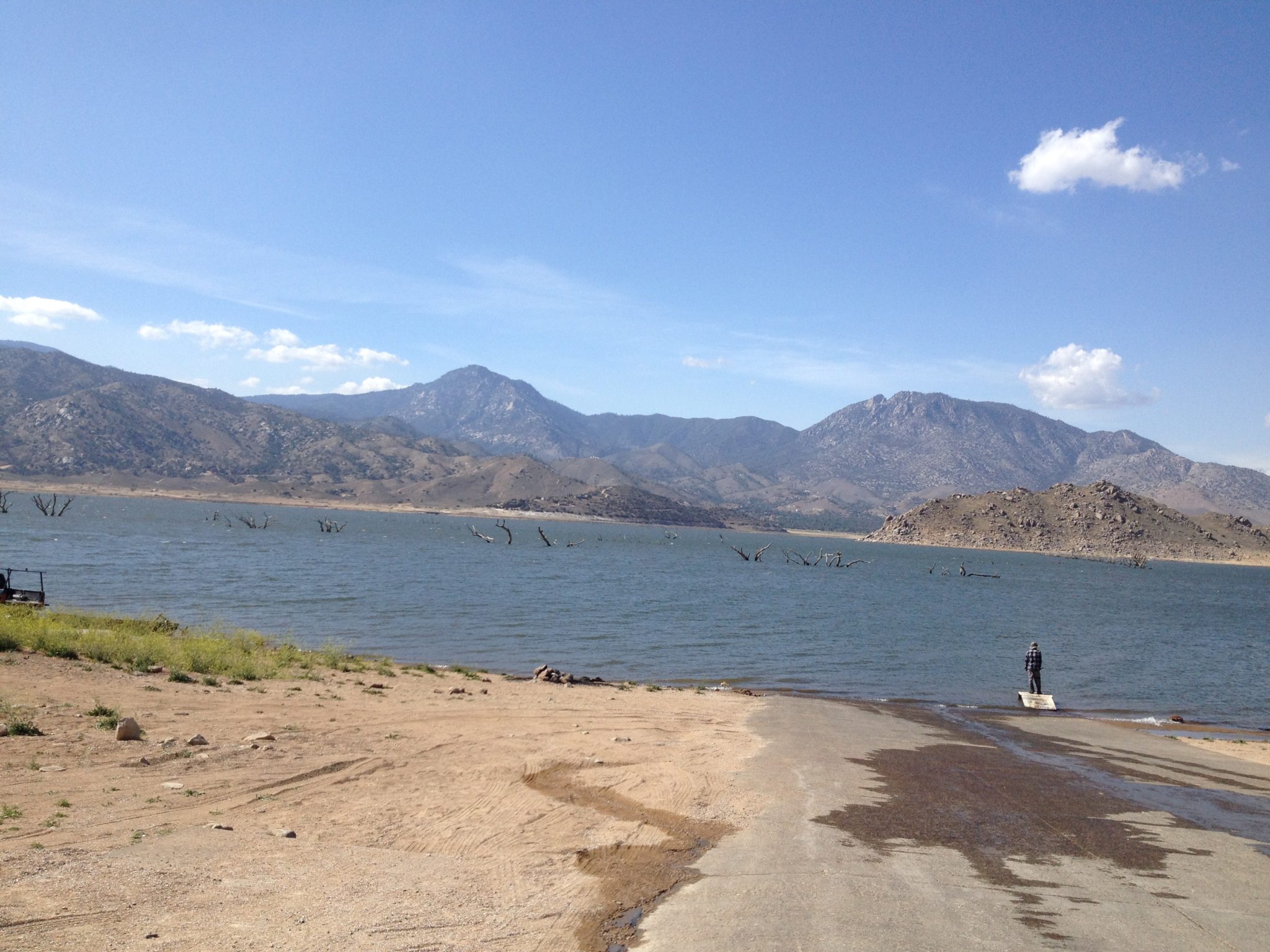
With the current drought, Lake Isabella is a puddle of what it used to be…but it’s amazing what the lake has hidden all these years. The lake has not been this low since 1977 and is the second lowest level since the dams were finished in 1953.
In April, I took two trips back to the areas near where the original towns of Isabella and Kernville stood before the lake covered them and their history. Unfortunately during my visit, the actual townsite of Isabella was still under several feet of water but the remains of the trees that use to shade the town are clearly visable sticking out of the lake in several photos.
Map to April 2014 photos


Thanks to Joel Windmiller for his assistance and historical photos of Old Isabella.