Category Archives: Guide

Highway Tips #2 – Signs

Road signs come in many different sizes, shapes, and colors. Each one carries a specific meaning to help guide you down the road in a safe manner. This installment will discuss each of the types of signs and what they mean. Road signs come in a variety of colors. Each color has a meaning, which can be quite important to know. The colors run from red, yellow, white, blue, green, brown, and orange.

Old stop sign along Topanga Canyon Blvd in Los Angeles, CA.

Red signs mean something is prohibited. Only a few signs use this color – stop signs and wrong-way signs are the most common of these. Stop signs are also the only one that is octagonal. The color red was not the first choice, however. Stop signs used to be yellow with black lettering. Color might depend on where you were. Eventually, stop signs became standardized with a red background and white lettering. Yield signs and some no parking signs also use this color scheme. While yield signs don’t prohibit movement, they are there to warn you of opposing or side traffic.

High wind advisory sign along State 41 in central California/

Yellow signs are advisory or warning. Things such as upcoming intersections, curves, and other roadway hazards are generally marked with yellow signs. Curves are a good example of this. The speed signs at curves are advising you of a safe speed for the curve. They aren’t a speed limit for the curve. It is a generally good idea to travel at the advised speed. Depending on many conditions, you may be able to go faster that the posted speed. With this in mind, I have found that 25 mph seems to be a breaking point for curves. Curves posted at 25 mph or higher can generally be driven faster. When they are posted lower than 25 mph, slowing down is highly advised. I’ve seen speeds as low as 5 mph posted on some roadways. I’ve also seen speeds as high as 60 mph. A curve with that high a speed is not a problem, but may be in an area with few curves and it is nice to know you don’t have to slow for it. Upcoming intersections are also posted with yellow signs. These signs tell you not that one is coming up but what type it is. Some signs are customized to show specific intersections, especially if it is a blind intersection in a curve.

Signage heading southbound toward Solemint Junction. Hwy 14 used to turn here to head east on Soledad Canyon Road from 1963-1972.

Black and white signs are regulatory signs, meaning they show some sort of rule that must be obeyed. Speed limit signs, for example, use this scheme. This is different than the curve advisory signs, which also show speed, as these signs show the maximum limit, not the advised limit. Parking signs are also generally in black and white as they limit or restrict parking in an area. Other signs in this category include bike lanes, passing, and other signs restricting either the movement or type of vehicle allowed in an area or lane.

Next services sign in Utah, which are located in Hinckley.

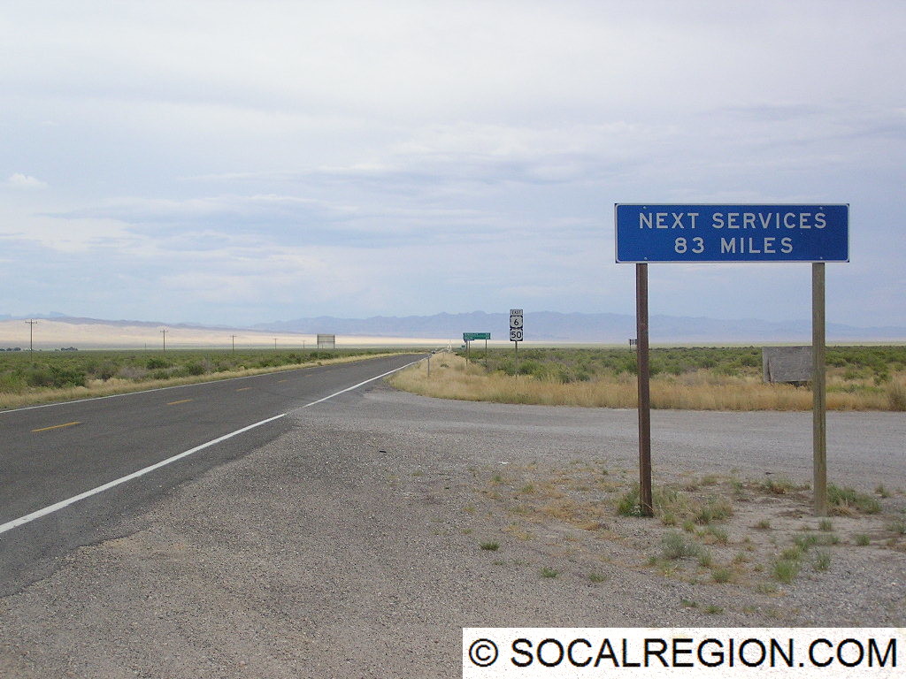
Blue signs are very specific in use. They act as guides to hospitals, telephones, and where services can be obtained. Roadside services can include gas stations, food, and lodging. These signs can be quite helpful for roadway users that are unfamiliar with the area and are not sure what sort of services can be obtained at a particular exit. Use of these signs varies by state as well. Some states show specific businesses, where others are more general, e.g. “Gas, Food, Lodging – Next Exit”.

Signage at a roadway junction.

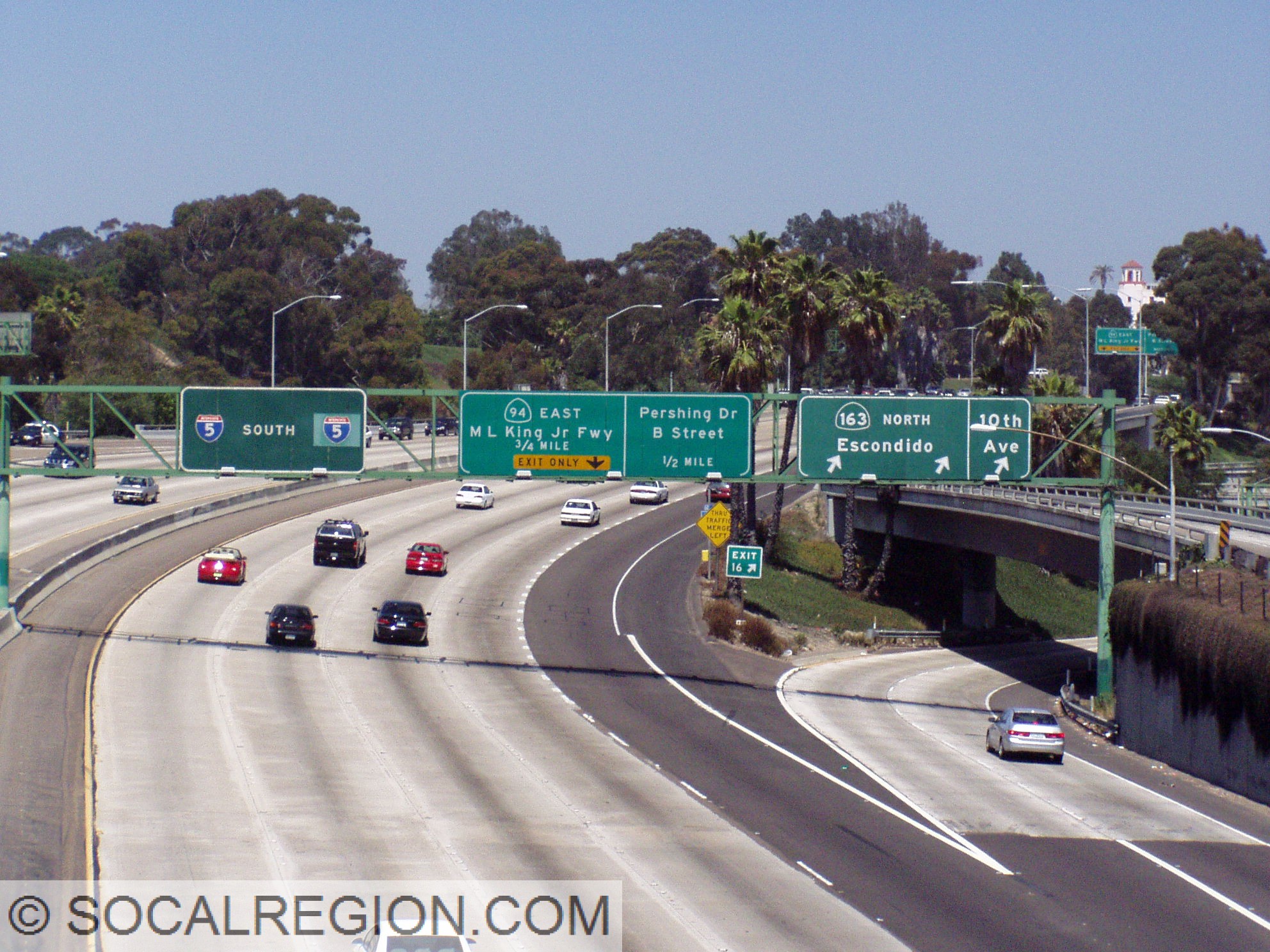
Green signs are also guide signs. These give directions, by use of an arrow, to locations such as cities and roadways. They also give mileage to locations along a route. On freeways they generally show distances to the next exit, where others show distance to the next three cities. They may also mark things such as bike routes, which are roadways where there is no marked lane specific for bicycles but may be easier for bicycling in general.

Historic US 6 signage at Acton Junction.

There are also brown signs which mark recreation and historic area, such as beaches and parks. Park lands, such as national monuments, are marked with brown signs as well as forest areas. Beaches, such as the various State Beaches along the coast are marked with these brown signs as well.

Another view of the HOV bridge with a new exit sign below over I-5 north.

The last signs covered here are orange. These are for construction areas. These signs perform a wide variety of tasks but always mark a construction area. These are to be heeded in part to ensure the safety of construction workers. Detour signs also use this color scheme and mark an alternate route in case the main route is closed. Always use caution in areas marked with orange signs. In addition to construction workers, roadway quality may greatly vary as well. Well-paved roads may be turned to dirt for a time during the construction and speeds may be greatly reduced from normal.

As you can see, road signs come on many shapes and colors. Each help roadway users get to their destination in all sorts of ways. So, next time you’re out on the road, keep this in mind and it may help you on your journey to wherever you may be going.

Highway Tips – Roadway Striping

This is the first part of a new series on SoCalRegion where we will discuss various topics related to roadways, their design, signage, as well as other features to help assist all road users in traveling throughout California. Many of these features exist in other states, but some have a different take on things.

Roadway striping comes in a few different colors and designs. Each of these have a meaning. Even without using signs, you can use striping to help determine what is going on with a roadway. Using these clues can also help aid with navigation in unfamiliar areas.

The Basics

Standard double-yellow striping

Let’s start with the basics. Two basic elements of striping are common throughout the United States – yellow means dividing opposing traffic and white means same direction of traffic. These colors remain nearly universal throughout all 50 states. Double striping, no matter the color, denotes a “no passing” or “no crossing” location. Passing, assuming the roadway is two lanes wide, can be done when the stripe on your side is broken. When the whole stripe is broken, both sides can pass.

Divided Roads

Two sets of double yellow stripes dividing a roadway

Multilane highways are divided in a variety of ways. When it comes to striping, there are three main types. The first is still the basic double-yellow striping. When a roadway needs a bit more of a divider, two sets of double yellow stripes are placed. These are considered “painted barriers” and are not to be crossed in any way. Some of these roadways have breaks in the striping, usually on one side only, to allow for turns onto side streets or driveways.

Common center turn lanes are another way to divide a roadway. These can exist even on two lane roadways but are more common on multilane roads. These center lanes are striped with a solid yellow line on the outside and a broken yellow line on the inside. These lanes allow both directions to make left turns.

Common turn lane on a two lane roadway. A sharrow is also visible here.

Freeways

Freeways, while the striping is color coded the same way as regular roads, do have some different styles and meanings. Exit Only lanes, meaning lanes that will exit a freeway shortly, have something Caltrans calls – Elephant Tracks. When a lane is going to leave the freeway, the striping changes in thickness and frequency. These stripes are wider and a little more frequent than regular lane striping. It is one of the visual cues that is designed to help motorists determine if they are in the correct lane, regardless of signage.

Souith at the 163, the “Four Level” interchange in San Diego. Here you can see the transition to exit only striping for State 94 on I-5. Also note the change at the gore point for the shoulder striping.

At the exit itself, the shoulder striping in California has a unique modification. Designed to aid motorists in times of reduced visibility, the shoulder stripe has a break at the exit and flares out to mark the exit. In areas subject to heavy fog, there is an additional exit cue – reflectors. These are off to the side of the shoulder striping at intervals and are in rows of three, two, then one at the exit.

Where most freeways have only one HOV lane, this has two from Adams Ave south to I-105.
118 through the northern San Fernando Valley near Reseda Blvd.

HOV lane striping is another variation found on California freeways. Until a few years ago, these lane were, in general, striped with a double set of double yellow lines, acting as a painted barrier. There were variations based on available space as well. Specific entry/exit points where marked with broken white striping. These stripes are now being changed to double white lines with broken striping at the entry/exit points.

As you can see, there are many ways to determine what is going on with a roadway without looking at signage. Striping can help guide road users in ways signage cannot. So, when you are in unfamiliar territory or in conditions where you can’t see the signs, use these clues to help direct you to where you are going. The stripes are there to help!

What is a “C-Monument”?

Roadways and their rights-of-way are marked in various ways. Originally, roadway rights-of-way were poorly marked, and as a result, changed quite a bit. These changes made travel sometimes rather confusing as the roadway path may have changed before the map the traveler used changed. This sort of problem also cost the State quite a bit of money as they had to not only correct the problem, but also deal with the potential land costs of a new alignment.

Starting in 1914, the California Highway Commission came up with a plan to mark the right-of-way in a more permanent manner. Their solution – a “C-Monument”. While not the official name, which is simply “survey monument” or “right of way monument”, it aptly describes the marker. These monuments would be placed at the edge of the right-of-way at intervals along tangents (straightaways) and at curve points (BC and EC or Beginning of Curve and End of Curve). Optimally, these monuments would project about one foot above the ground with the C facing the roadway. The C stood for California, as in the California Highway Commission. At the top of the monument, a copper plug was placed to help guide surveyors. Per the January 1949 Division of Highways Standard Specifications manual, “Monuments shall be set firmly and vertically in the ground to a depth of at least three feet.”

Old C-Monument State Highway Right Of Way marker from 1930.
C-Monument along a 1930’s alignment of US 6 in Red Rock Canyon.

The C-monument was actively placed and used for many years, though when it finally was out of use seemed to vary between districts. In San Diego County in District 11, for example, they were used along freeways constructed in the mid to late 1950’s. Los Angeles County, within District 7, seemed to stop using them sometime in the late 1930’s. Today, the monuments that remain are still valid survey monuments. While not placed anymore, Caltrans, as well as local agencies, still use them. As such, please do not disturb or collect them if they are still in place.  Finding them along a roadway also doesn’t automatically make it an old State Highway. Some counties also used these monuments as they were a part of the standard plans for any project that involved state or federal dollars, such as Del Dios Highway between Lake Hodges and Rancho Santa Fe in San Diego County.

Finding these monuments is actually quite simple. Typically, roadway rights-of-way ranged anywhere from 100′ to more than 300′. Find a curve in the roadway you are looking at and look for one on either side of the roadway about 50 to 150′ away from the centerline of the roadway. In mountainous areas, the uphill one tends to be easier to spot than the downhill side. Fence lines, power lines, and other similar features can be used to indicate the right-of-way edge. As they can still be used today as survey monuments, some are marked with paddles or other objects to make a surveyors job easier when locating them. Placer County uses a white “R/W” paddle. Caltrans District 9, at least in Inyo County, uses orange poles as location markers.

Related Links:

Seeking Old Highways – A Guide

August 12, 2017 Cajon Pass Highway Tour – Updated

South end of Blue Cut showing fire damage.

On August 12, 2017, I will be hosting this websites first highway tour in the Cajon Pass area. This tour will cover the roadway from Verdemont to Cajon Summit. Some portions will have to be skipped, unfortunately, due to fire-related closures. The start of the tour has changed from the initial announcement. It will now begin at Devore, in front of Tony’s Diner at 18291 Cajon Blvd, San Bernardino, CA 92407 at 8 am. Please do not park in their parking lot. There is plenty of on-street and off-street parking in the area.

[wpgmza id=”1″]

After a brief introduction, we plan to leave at about 8:30 am. The tour will stop at the following locations:

  • Verdemont (backtrack)
  • Cajon Blvd (at the freeway)
  • Kenwood Ave
  • Keenbrook
  • Blue Cut
  • Debris Cone Creek
  • Cajon Junction
  • Cajon Summit

Additional stops may be added if needed. I strongly recommend bringing water and snacks as there are few water/food stops along the route. Please RSVP if you plan to attend this tour. Again, we will be leaving the starting point no later than 8:30 am. Please RSVP no later than August 11 so that I can get a rough number of how many will attend. I look forward to seeing you out there!

US 6 Tour goes east!

It has been a while since I’ve added to my US 6 tour. For quite some time, it “only” went to Tonopah, Nevada. While that town makes for a good end point, it left quite a bit of very interesting and scenic highway out of the tour. US 6 across Nevada is one of the emptiest highways in the lower 48 states. It gives travelers and geologists alike a very good cross section of the Great Basin as well as a look at the mining past of Nevada. With that in mind, my US 6 tour now extends to the Utah / Nevada State Line, covering approximately 620 miles of roadway.

Take your time and enjoy the tour!

Virtual Tour of US 6 Introduction