On Sunday, February 24, 2012, I went out for a ride to Campo on my motorcycle. I wanted to take some photos of the old sections of Hwy 94 and the weather was great for a ride. Starting out, it was a quick freeway ride to Campo Junction, where the two lane portion of Hwy 94 starts. That is where the fun begins. It was also where the first stop was, at the 1929 Sweetwater River bridge.
1929 Sweetwater River Bridge
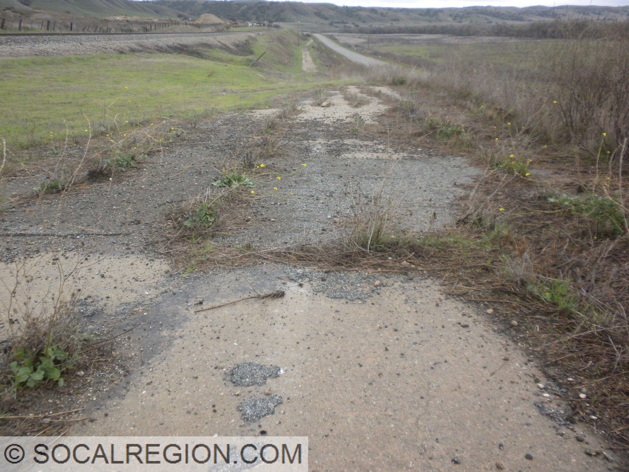
After I left the bridge, my next stop was at a section of old concrete I had discovered on a previous ride. With a camera in hand, it was time to get photos and explore some more. I didn’t find any date stamps, but I did find lots of old striping. Still pretty cool.
1920’s concrete near Jamul
After Jamul, there was an old creek crossing with concrete I had found recently. It appears to be an Arizona type crossing instead of a culvert. The new crossing is now a culvert. I’m not sure its age, but I’m going to guess it is from the 1930’s. Also in the area is a neat bridge crossing Dulzura Creek at Otay Lakes Road. It was built in 1947 and has a nice sleek look.
Original low-water crossing on Hwy 94
1947 Dulzura Creek Bridge
In Dulzura, I stopped at a 1930 bridge which had bridge abutments near it from an even older span. I couldn’t quite tell what sort of a bridge the original one was, but was most likely wooden.
1930 Dulzura Creek Bridge at Dulzura
Further up the road at Cottonwood Creek, there are a few items of interest. The “new” Cottonwood Creek bridge from 1954 bypassed both the original bridge and large section of the alignment. Barrett Smith Road follows the old alignment up the steep grade out of Barrett Junction.
Cottonwood Creek crossing on Hwy 94 at Barrett Junction
At Dogpatch, Hwy 94 crosses the San Diego and Arizona Railroad for the first time under a 1915 bridge. Just after that bridge, there is another 1947 bridge. Adjacent to the 1947 span, there are abutments to an earlier bridge.
1947 bridge at Dogpatch
1915 Doigpatch UP where the San Diego and Arizona Railroad crosses
My last stop was Campo. I needed to fuel up and get photos of the bridge at Campo Creek. It is the last bridge with wooden railing on Hwy 94. After I stopped here, I headed back to town on Hwy 94. I enjoyed the ride and the scenery. It was the first time in a long time that I had stopped so many times on 94. The last few trips have been just riding or driving.
I know it has been a while since I’ve posted anything. Many things have happened. I’ve done a lot of traveling, some by train, some by car, some by bicycle, and now a new addition. Travel by motorcycle. I never saw myself on a motorcycle. I could easily talk myself out of one. I don’t own a car anymore, not since August 2011. I’ve been riding a motorcycle since November 2012 and I’ve put many miles on it so far. My motorcycle is a 2005 Kawasaki Ninja 500R. Now, before you all think I’m some crazy sportbiker… mine is a bit different. It has a more upright riding position and hooks for a cargo net. It does go fast… its name is “Leonardo”. The bike is a lot of fun and is great to travel with.
Skipping a lot of travel… though I will try to post more photos from my trips as I can… I recently was on Mesa Grande Road near Lake Henshaw in northern San Diego County on my motorcycle. It was there I found this neat WPA bridge with brass letters still in place. Adjacent to it was the original bridge, or what was left of it. I figure it was from the 1910’s or earlier by its construction.
Original bridge. It looks like it was just wooden beams laid across.
Real nice WPA brass lettering still intact. A rare sight indeed.
Stonework along the side of the WPA bridge/culvert.
On Sunday, I went to the Redlands area to drop off a friend. I figured, why not see some old highway in the area and make the trip back more fun? So, after dropping him off, I headed over to Redlands Blvd. This is a section of old US 99 that still retains its concrete paving from the late 1940’s. I never really got any photos of it before, so it was good to see it still there. From Citrus Ave east, the roadway is more of an expressway, with a wide median and limited access.
After Redlands, the next section of old highway would prove a bit more interesting to get to. It was a short section of concrete paving, from the 1920’s most likely, and was located adjacent to the 10 freeway. I had to actually pull off the freeway shoulder to drive the short section. It was pretty neat, seeing as how this had been realigned so many times since that concrete was poured. I was hoping to return to the freeway by simply driving through. That idea was quickly thwarted when I found a tall curb at the shoulder. I had to back up and get on where I pulled off. So much for trying to be inconspicuous!
Redlands Blvd, “in town”
Divided section of Redlands Blvd, like an expressway.
Some of the concrete visible… seen just to the right of the shoulder.
More paving, both lanes now visible.
My next stop would be Robert Rd, near Cherry Valley Blvd. This section is threatened with removal or repaving as it is adjacent to a new large housing tract. So far, it is still intact. This nice concrete section dates to about 1928 and is one of the last sections of intact concrete around here. I took many photos here, hoping they wouldn’t be my last. The economic slowdown seems to have helped here, as the housing tract construction has slowed dramatically. At this point, I figured, I’ve gone this far… might as well go to the 60 junction and look around. So, I got back on the freeway, and took the San Timoteo Canyon Road exit. A frontage road heads east here, on the south side of the freeway. A portion of it is old US 99, complete with a 1939 bridge over San Timoteo Creek. Upon closer inspection of the bridge, I found that the eastbound I-10 bridge was also a part of old US 99. It was the original westbound bridge for the expressway, built in 1951. Now traffic is going the wrong way over it, from a historical context. One final stop was to be made, the old US 99 / US 60 / US 70 junction at the edge of Beaumont.
Short section of Roberts Rd that is now a driveway.
Roberts Rd, fairly pristine 1920’s concrete.
San Timoteo Creek Bridge from 1939
Old westbound bridge from 1950, now eastbound I-10.
I’d seen what appeared to be bridge piers and concrete approaches to an old bridge just north of the current SR-60. It turns out, that is exactly what they were. In 1936, the current westbound bridge for SR-60 (old US 60), was built. It replaced an earlier bridge, the one that I had been seeing pieces of. Today was finally my chance to walk around and see the old pieces. I was rather amazed at how much was left, considering how long ago it was all torn out. A fair amount of the eastern approach to the bridge remained, most of it buried under a thin layer of dirt. There wasn’t anything left of the western approach. I also got some photos of the exit sign for the 60 West from the 10 East. The sign was from 1960, and was overlaid with a SR-60 sign. Yes, there is a US 60 shield under there… just hope the overlay panel falls off at some point! After hiking around, it was time to head back. The approaching storm was getting worse, and the winds were picking up. I had a long drive ahead, and didn’t really want to do it in heavy rain. Thankfully, all I had to deal with was heavy winds and dust at times. I finally got to see some sections of old US 99 that I either hadn’t seen before, or weren’t sure were still around. More trips will be made up this way, just not during summer.
1936 Beaumont Overhead, now westbound SR-60
Remains of the earlier Beaumont Overhead
Some of the old approach still exists, with concrete.
My friend Jake and I left San Diego rather early, about 4:30 am. Our goal was to get up to the San Luis Obispo area as early as we could, so that we could take our time north of there to the Gilroy / Hollister area. It seemed to have worked. As we were making pretty good time, we decided to check out some old alignments of US 101 a bit earlier. We followed some alignments near Gaviota and Buellton, both of which had good sections of old concrete. After that, we didn’t make any major stops until north of San Luis Obispo.
1930 Bradley Bridge.
Piers for the original Bradley Bridge, just upriver.
Pre-1939 alignment of US 101, with single-slab concrete and white striping.
At Bradley, we stopped at the large bridge over the Salinas River at the north end of town. It was built in 1931, replacing a multiple through-truss span built in the 1910’s. Much to our surprise and enjoyment, we got a much needed break from the rain here. The break was just long enough to walk the span and take many photos. I hadn’t had the opportunity to really view the bridge, so this was quite welcome. Once we left the bridge, we took the old alignment of 101 south back to the freeway, taking a slight detour onto an even older alignment, bypassed in 1939. Most of it was still fairly well paved, complete with sections of double white striping. One spot, however, proved to be a bit trickier. Some years in the past, a small landslide took out a portion of the roadway. A short dirt bypass was made, which was rather muddy after all the rains. I got of the car to scout the roadway ahead, to see if it was passable. I decided it was, and the car was able to make it. It did slide a bit down the slope, but not to worry, it wasn’t a problem. By the time we got back to the main road, the tires had acquired a thick ring of mud, almost a new tire in itself. Hey, it’s a rental car right?
Original CSAA FAP sign from 1929. Note the diamond on top.
an Lucas Bridge – from 1915, at least the southern two spans anyway.
Getting back to current US 101, we continued north to San Ardo, where the old highway crossed the river again. The bridge here is very similar to the North Bradley Bridge, built in 1929, but without the old railing. In 2001, the span was seismically retrofitted and the old railing was removed. One thing that was not removed, and only discovered by us on this trip, was a 1929 FAP sign, complete with a CSAA yellow diamond. These are rare to find out in the field, so it was quite something to see. This section of the road, from San Ardo up to San Lucas, was the last section of two-lane highway on US 101 from San Francisco to Los Angeles. It was bypassed in 1971. It still makes a nice detour from the main highway, with little traffic to deal with. At the north end in San Lucas, there is another old bridge nearby, crossing the Salinas River on Lockwood-San Lucas Road. That bridge, from 1915, is a through-truss span. Some of the girders had Carnegie Steel stamped on them.
Still heading north, we arrived at Gonzales, where we diverged from US 101 to see another old bridge over the Salinas River. I first found this bridge in 2001 on my first bicycle tour. I wasn’t planning to take that route at the time, but had to make the detour as there was no other route available. The bridge, a 1930 through-girder span, reminded me of another bridge that was near where I used to live. Through-girder spans are rare, usually used by railroads not highways. Instead of returning to US 101, we decided to change course, and follow the River Road on the west side of the valley. I hadn’t been there before, and it took us north. So, why not take a different path?
We crossed back over the river near Chualar, and went back to US 101. We stayed on it until the south end of Salinas, where we exited onto Abbot St, the old alignment and business route. The southern end of Salinas had the distinction of still having old US highway shields in place until the early 2000’s. The signs are gone, but the porcelain business banners remain. We found two of them, one northbound and one southbound. Heading through Salinas started off alright, but as we got closer to the center of town, things went downhill – fast (or was it slow). Traffic increased, roads turned in confusing directions and we didn’t have a map. Still, we managed to get through town and onto the road we wanted – San Juan Grade.
Old sign with the straps still there for the old US shields in Salinas.
San Juan Grade Road is the original alignment of US 101 from Salinas to San Juan Bautista. Having been bypassed in 1932, the roadway still retains most of its old feel. It wasn’t widened, and much of the original 15’ concrete is still visible. A few of the curves were straightened, but even that appears to have been done long ago. A lot of the old wooden guard railing is still in place, mostly on the north side of the summit. South of the summit, a few bridges with pipe railing are still intact. Rain and fog prevented a lot of good photos from being taken, but we still got a few. On the north side, in San Benito County, more of the old concrete was preserved. It was good to see such an old highway in as good a shape as this was. At the north end, where it met old SR-156, there was an old white directional sign from 1959 which was on our list of things to see. Having taken care of that, we headed east to Hollister. It was time for some geological tourism.
Old concrete and railing. A very nice mix.
Sometimes, rocks will fall, this one was strangely stopped by the railing. Must not have been going fast.
More old concrete on San Juan Grade.
Nice old sign from 1959.
Hollister, not the town from which the clothing comes from, is a growing suburb in the southern Bay Area. It still has a lot of farms surrounding it, and still retains a lot of its old downtown. It also is well known to geologists. The Calaveras Fault, a branch of the San Andreas Fault, runs right through town. This particular segment of the fault creeps. Most fault move in large jolts, known as earthquakes. This moves along like a conveyor belt, but much slower. The results can still be quite dramatic. Along many streets in the northwestern end of Hollister, there are offset curbs and sidewalks. A portion of an old fault scarp is also visible, usually as an abrupt rise in the street. All the roadways crossing the fault have fractures, bumps, and lots of patching. The earth waits for no one, and is more than willing to show its power. Sometimes structures lie atop the fault, and they too have been made a bit askew. Some are just cracked, while others are twisted out of shape. I noticed one such structure, on Suiter St, that was so badly cracked, I wondered how much longer it would stay up. It was certainly proof positive why the Alquist-Priolo Zoning Act was created.
Roadway cracking and bent curb on 7th Street next to Dunne Memorial Park.
Note the columns. House is a bit twisted from the fault creep, on 4th St.
More en echelon fractures on 5th St.
4th St, notice the bend in the curb and cracked panels in the sidewalk.
Pavement has to be redone often here, it also sags a bit.
Offset here is about a foot.
Once straight, now bent.
Through Dunne Memorial Park, the low fault scarp becomes quite visible.
After seeing all we could see of the Calaveras Fault, we headed out of town, first following the new alignment of Hwy 25. The new bypass runs to the east of town, connecting two places that 25 used to turn at. From there, it was on to Gilroy, where we stayed for the evening. Another adventure awaited us the next day – the Big Sur Coast!